RE2301: GIS for Real Estate
Semester 2, 2017/2018
This project is a spatial network analysis of the BlueSG car service in Singapore. Cars took up 75% of the total vehicle population in Singapore, excluding goods and heavy vehicles (LTA, 2017). This project uses GIS spatial and network analysis tools to generate potential BlueSG parking lots with two criteria:
Location-Allocation analysis was set to ‘Maximise Coverage’ problem type. By increasing the number of parking stations to 50, it will reap the maximum marginal returns in terms of demand points met while minimising the additional cost of installing new charging stations.
- Distance as impedance selected. As BlueSG aims to ‘complement the public transport network’ (BlueSG, 2017a), these locations should be in walking distance or as available as present public transport services such as bus stops and MRT stations, explaining our decision of using distance as impedance
- Greatest marginal increase with additional point.
Location-Allocation analysis was set to ‘Maximise Coverage’ problem type. By increasing the number of parking stations to 50, it will reap the maximum marginal returns in terms of demand points met while minimising the additional cost of installing new charging stations.
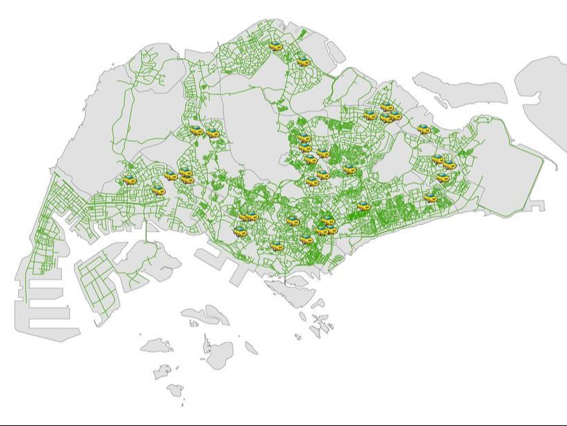
1: Current BlueSG charging stations and road networks in Singapore
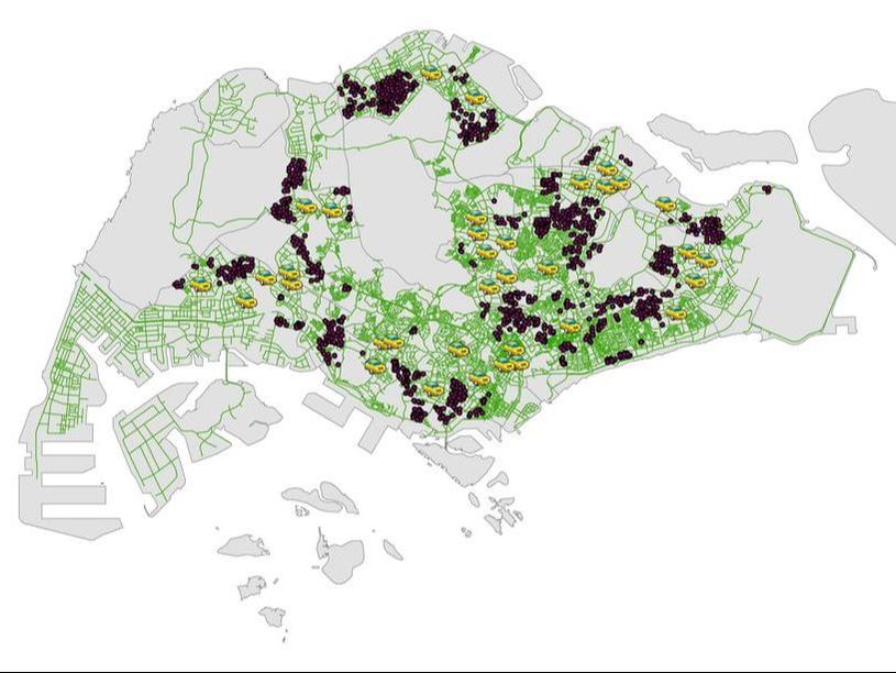
4: All possible locations of new BlueSG charging stations
|
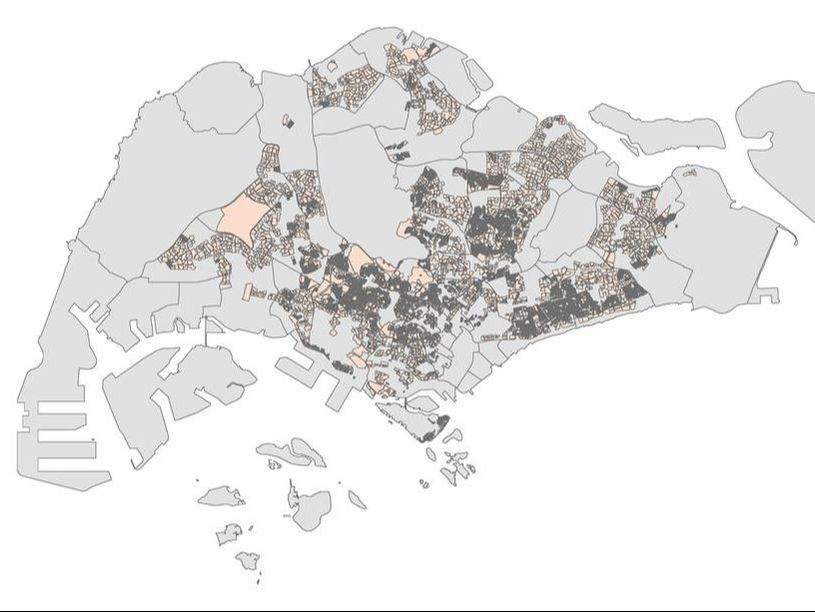
2: Residential land uses zones in Singapore
(land-use data from Master Plan 2014 from Data.gov.sg)
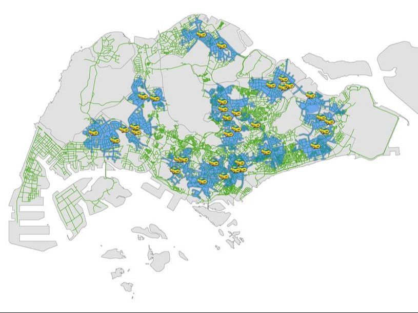
5: Service Area of current BlueSG charging stations
|
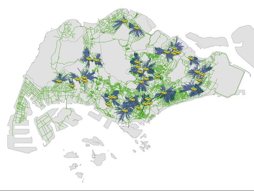
3: Current BlueSG charging stations using Location-Allocation analysis
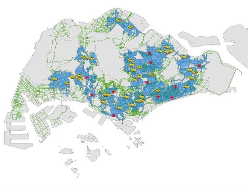
6: Service area of the proposed locations of BlueSG charging stations
|
Ways to improve:
Cost-distance is not the only factor transport users consider in their decision-making process. Other factors include convenience, monetary savings (of other, shorter routes) etc. These are hard to quantify and even difficult or impossible to obtain.
The above analysis gives an equal weight to each residential land use (public or private), regardless of the number of people inhabiting that space. Data on the number of occupants per residential area could improve the analysis. With this data each demand point could be weighted according to the number of occupants instead.
