GE4221: Field Investigation in Human Geography (Cambodia)
29 September 2018
The RAMSAR 999 site of Stung Treng, Cambodia, was mapped. A RAMSAR site is a designated wetland site under the Ramsar Convemtion by the UNESCO, which aim for conservation and sustainable use of resources for present and future generations.
The purpose was to present a map with updated information of the site. It is along the upper portion of the Mekong River of Cambodia, along the Lao-Cambodia border. These areas are dynamic and react to changes in waterflow or sediment composition in the water. Islands are constantly being eroded or constructed due to the hydrodynamics of the river. We hope that by the ephemeral nature of landscapes and how they may potentially affect the lives of communities, more attention could be given to the awareness and environmental conservation of the area given its invaluable assets such as fish production and tourism related services.
The purpose was to present a map with updated information of the site. It is along the upper portion of the Mekong River of Cambodia, along the Lao-Cambodia border. These areas are dynamic and react to changes in waterflow or sediment composition in the water. Islands are constantly being eroded or constructed due to the hydrodynamics of the river. We hope that by the ephemeral nature of landscapes and how they may potentially affect the lives of communities, more attention could be given to the awareness and environmental conservation of the area given its invaluable assets such as fish production and tourism related services.
|
|
Layers and how to make sense of them:
|
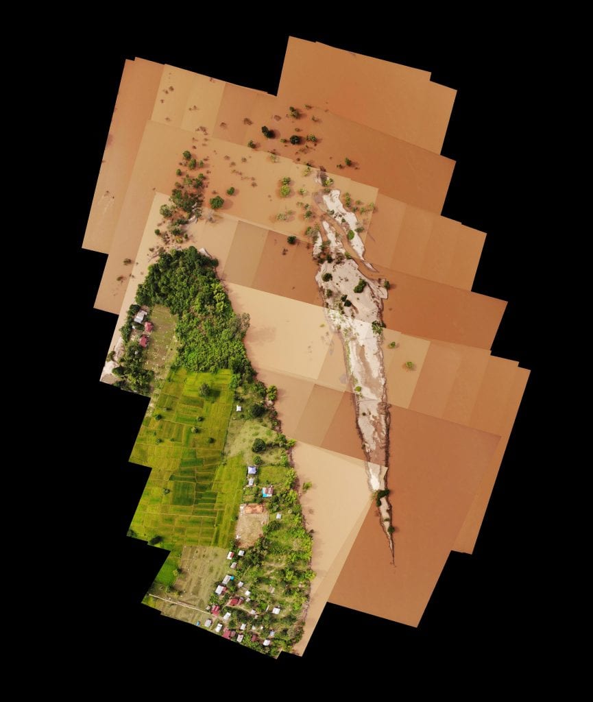
Island aerial picture stitched from photos taken by the drone
|
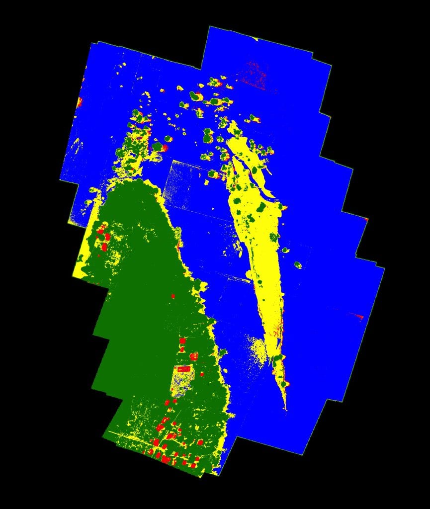
Processed image – land-use classification of Island aerial photo
|
