Internship with Conservation International (Timor-Leste)
May - July 2018
GIS and Data Management Intern
GIS and Data Management Intern
Introduction
Conservation International (CI) Timor-Leste has given me invaluable learning opportunities during my internship. As a GIS and Data Management intern, I was exposed to the entire process of conservation from a non-governmental organisation (NGO) point-of-view. This internship allowed me to build technical skills such as creating and refining a comprehensive database and generating professional maps for government, organisations and community use. I took part in a participatory mapping and community consultations in Nino Konis Santana National Park (NKSNP). I learned how GIS data are collected, managed and digitised. The opportunity to immerse in cross-cultural communication and work with the highly diverse international community present in Dili prepares me for future international and multicultural settings of working environments, especially for environmental projects.
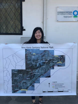
Nino Konis Santana National Park
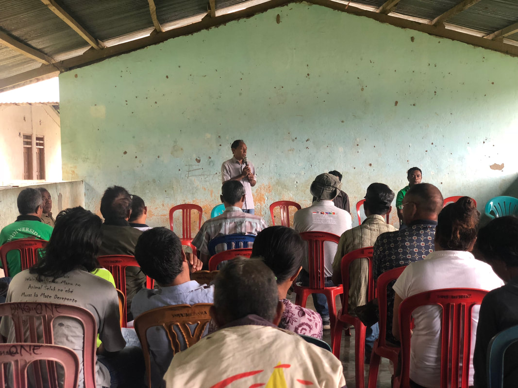
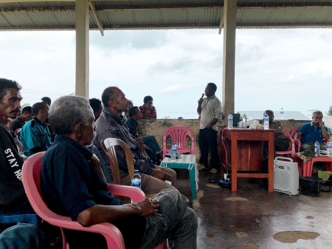
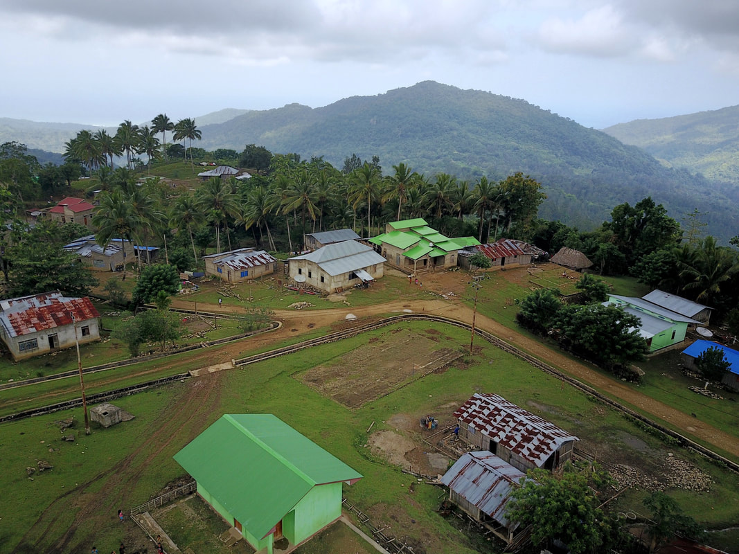
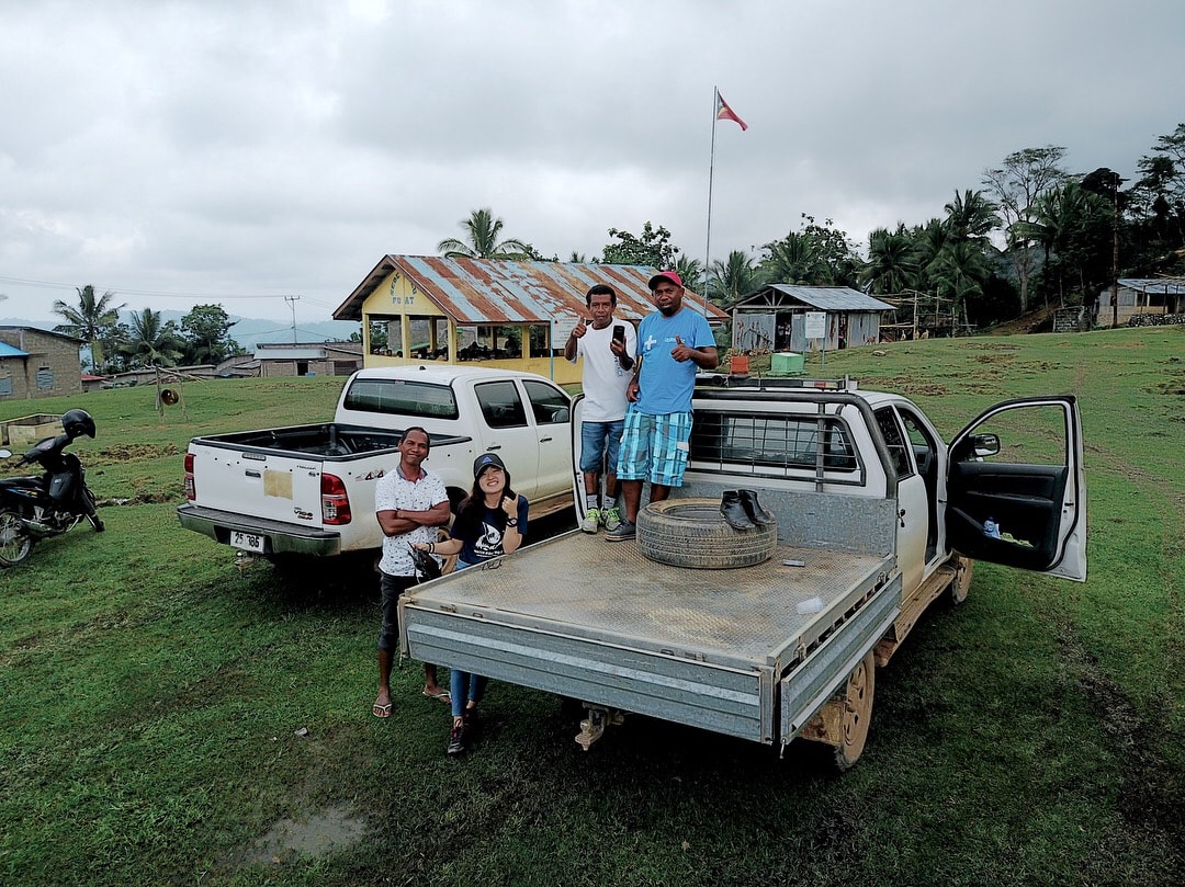

NKSNP was established in 2007 and it is the first national park of East Timor, located in the eastern tip of Timor-Leste. I was given the opportunity to be part of the team representing CI, together with the Ministry of Forestry, Agriculture and Fisheries, Land- use Planning and Tourism etc, for a participatory mapping and survey in NKSNP for 14 days. Our base was in Lospalos and we travelled to 9 other sucos (villages) Com, Mehara, Tutuala, Bauro, Muapitine, Lore I, Lore II, Fuat and Iliomar I to conduct community consultations.
The structure of the meetings is as followed: introduction of our team consisting of representatives of different stakeholders, explanation of the zoning process and its implications, followed by feedback and comments by the community (Q&A session). Although the meetings with the communities were in Tetum and Fataluku (a Lospalos dialect), my team was kind enough to translate most of it to English for me. It was heartening as well as unexpected that an NGO would be highly regarded and consulted in the management of the national park. In Singapore, initiatives rolled out by the government trump everything else and the government rarely consults and takes into account the knowledge and opinions of NGOs and local communities. Seeing and being part of such dynamic and respectful conversation, in a developing country no less, was an opportunity I did not expect and am so grateful for.
After accounting for the input gathered during the discussions, the number of zones we demarcated expended from two to four. The local communities shared with us the areas where their livestock travel and graze, requiring us to demarcate it as a buffer zone (zone 3). They shared where were areas of agriculture, settlement and potential tourism zones (zone 4) as well as areas needing high and medium protection (zone 1 and 2 respectively). Among these administrative matters, we also discussed the impacts on livelihood, proper tourism management and gender equality. An old villager mentioned that before the area could be established as a tourism spot, there are many other improvements that need to be made before, which was the need for structural improvements to the roads and facilities. The representative from Ministry of Land-use Land Planning and Tourism both acknowledged, promised and assured that development of the area was already in talks. All stakeholders were forward-looking and open-minded while receiving the NKS Management Plan, confident and realistic of what could or could not be achieved.
|
Travelling to different sucos each day and attending community meetings, I noticed similar sentiments across all communities. They were proud of what their suco could offer and hoped to see advancements of their home without losing their identity. Many raised concerns over influx of tourists and possible degradation of cultural and agricultural sites despite the potential improvement to local economic situation.
This trip to NKSNP has broadened my perspective of what conservation work entails. I have never been part of community engagement. This trip highlighted the importance of consulting local communities before any project implementation as there are specific knowledge that we would not have otherwise found out if we were to do the zoning as a team in Dili. On a lighter note, this 14-day trip around NKSNP was the highlight of my internship as I would not have imagined myself covering so many locations, including multiple remote areas accessible only by a 4-wheel-drive, visiting the most beautiful, untouched areas that the team and the local communities were trying so hard to conserve. |
|
GIS mapping for other projects
|
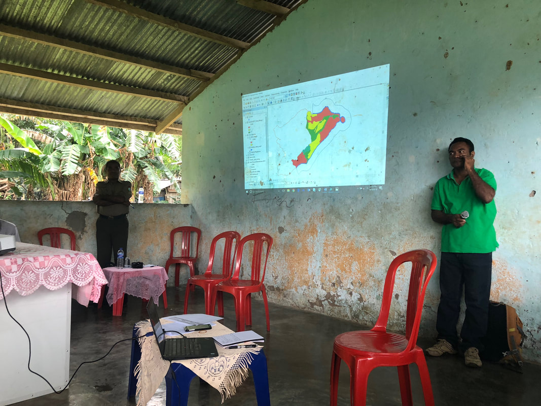
I was assigned ad-hoc mapping and data management tasks when the marine team returned from Com and Ataúro Island. I helped digitise the waypoints collected for seagrass and buffer zones. These information will be printed in their manual for the marine protected areas (MPAs) and no-take zones (NTZs) of both locations. I was also tasked to design maps for visiting consultants working with CI when required.
|
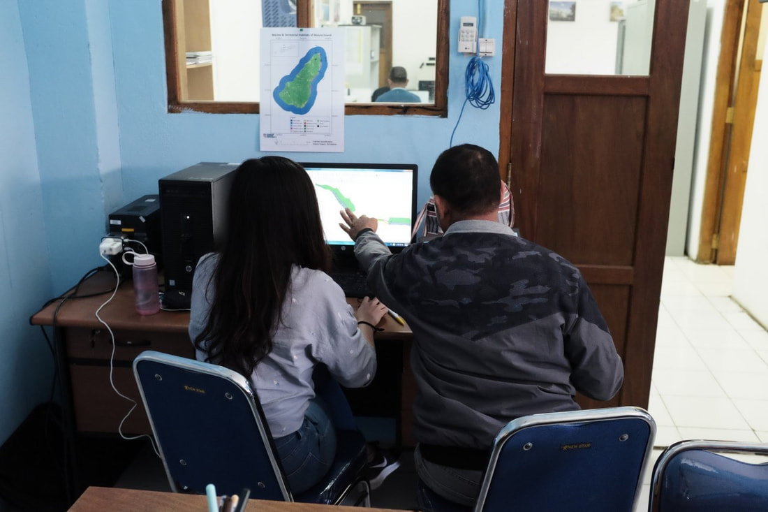
Anselmo (head of marine team) sharing results from the survey for me to digitise.
|
Volunteering at Universidade Nasional Timor Lorosa'e (UNTL)
Every Monday and Wednesday, I would head to UNTL after work to volunteer for the English Conversation Course (ECC). It is held everyday from 6-7PM by expat volunteers. ECC is free for all and even high school students come to the university to attend. It is an informal lesson where we would split the students into Basic, Intermediate and Advanced classes and have conversations in English. It was a joy being there as everyone was so genuine and excited to learn better English.
On Tuesdays, I would head to UNTL with my host to conduct math lessons to anyone who was early for ECC and was interested to learn. Our math lessons are 5-6PM and topics discussed were the students suggestions. They ranged from angles to pythagorus theorem to mass. It was heartening to see the lightbulb moments nearing the end of the class and when their smiles when they could solve (and check their answers!) similar math problems on their own.
On Tuesdays, I would head to UNTL with my host to conduct math lessons to anyone who was early for ECC and was interested to learn. Our math lessons are 5-6PM and topics discussed were the students suggestions. They ranged from angles to pythagorus theorem to mass. It was heartening to see the lightbulb moments nearing the end of the class and when their smiles when they could solve (and check their answers!) similar math problems on their own.
Conclusion
This invaluable internship opportunity enabled me to live and work independently away from home. GIS skills I learnt in my modules were put to test in a work scenario.
This experience with CI taught me how NGO conservation projects often hinges on effective collaboration and communication between local stakeholders and NGOs. It was heartening to sit in government and community consultations despite not understanding Tetum. I was touched, inspired and motivated being part of the parties coming together to discuss the possibilities and benefits of zoning NKSNP. Despite different goals, everyone was open to hearing alternative point of views and discussed objectively. This has strengthened my motivation to learn more about conservation work outside of my undergraduate studies as it is my dream to work in this field in the future.
Timor-Leste is at a developmental crossroad. The drive to develop as a new nation is interpreted differently across different stakeholders. I witnessed how environmental challenges are linked to economics, tourism, education and inequality. A step forward from this internship, I am eager and hopeful to explore the integration of conservation work with community development and the application of GIS and data management in conservation work.
